Survey Calculator
Dear
friends,
Please try the newly created surveyor calculator android App and give your review.
Thanks
Raja


https://play.google.com/store/apps/details?id=com.referencelinebr.myapplication
Dear
friends,
Please try the newly created surveyor calculator android App and give your review.
Thanks
Raja
https://play.google.com/store/apps/details?id=com.referencelinebr.myapplication
Surveyor Program, Reference Line, Circular Curve Spiral Curve, Traverse Bowditch
ReplyDeleteLand surveying essential calculation program, use for the field work. This Land survey calculator covers few transportation engineering survey calculation, which are needful for everyday survey work.
Programs included
1. Bearing Distance Calculator.
This Program Calculate Rectangular Coordinate <=> Polar Coordinate vise versa. This is the surveyor's everyday essential cogo program.
2. Intersection Point Calculator.
The Intersection program Calculate intersection coordinate of two given line. We can input 4 points coordinates or 2 points & 2 bearings.
3. Reference Line Program or Line and Offset Program
The Reference Line Program Calculate Local Linear & Offset Distance <=> Global Easting & Northing vise-versa. This is the most needed everyday essential cogo program for land surveyor.
4. Lat Long - UTM Coordinate Convertor
The Lat Long - UTM Coordinate Convertor Program will convert Latitude Longitude <=> Easting & Northing vise-versa. This program can gather GPS coordinate with the mobile inbuilt GPS or we can input coordinate manually too.
5. 3 Point Circle (or) Curve - Coordinate and Radius Calculator.
The Three Point Curve (3 Point Curve) Program Calculate the center point coordinate and radius of the curve passing through the 3 given point.
6. Circular Curve Setting Out Calculator.
The circular curve setting out calculator program Calculate the coordinate of the point within the circular curve. This program Calculate the Local Chainage & Offset <=> Global Easting & Northing vise-versa. Also this program can give multiple result for given start chainage an interval within the curve.
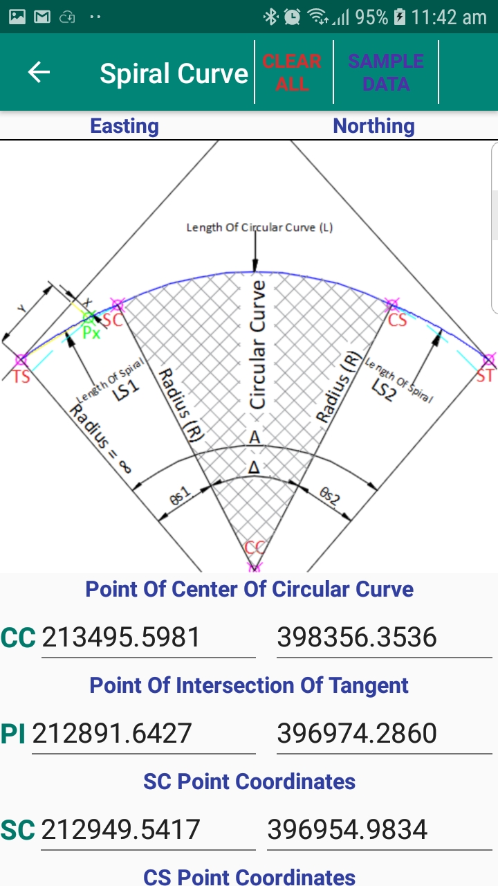
7. Spiral Curve Setting Out Calculator.
The circular curve setting out calculator program Calculate the coordinate of the point within the group of transition or spiral and circular curve. Local Chainage & Offset <=> Global Easting & Northing vise-versa. Also this program can give multiple result for given start chainage an interval within the curve.
8. Vertical Curve Setting Out Calculator.
This vertical curve program calculate the parabolic tangent offset at the given chainage. Also this program can give multiple result for given start chainage an interval within the curve.
9. 2D Transformation Calculator.
Transform coordinate between different coordinate origin and orientation, Source to Destination vise versa. Also this is the most needed everyday essential cogo program for land surveyor.
10. Area By Coordinate Calculator.
This will calculate the area of any polygon the area with the given XY co-ordinates. This Area By Coordinate Calculator newly added in our surveying calculator in version 4.0.
11. Link Traverse Calculation by Bowditch Rule
Traverse Calculation by Bowditch Rule program will calculate & give adjustment for angle traverse by Bowditch or Compass rule (25 unknown STN max). when you do the angle traverse at site on time you can in put the angle traverse details and quickly can get the traverse line accuracy details and final adjusted coordinates. Bowditch Rule or Compass rule is the most most common method of traverse adjustment.
12. Coordinate by Triangulation
This program helps to calculate the third unknown point coordinate with 2 known reference point and the distance from the unknown point.
Area by coordinates and link traverse calculation by Bowditch method programs are recently added in our survey calculator application.
hello sir how are you i think you are fine. sir i love your survey tool both mobile version or desktop version but i am facing a problem to convert utm to longitude or latitude coordinate i have alot of data and sir your app only support only one utm or longitude and latitude. so i am humble request to you please create a tool for this 🙏🏻🙏🏻.
DeleteI need registration key how to find for window 10 autocad 2018
ReplyDeleteThis comment has been removed by a blog administrator.
ReplyDeleteI NEED REGISTRATION KEY
ReplyDeletei want registration key
ReplyDeleteI want registration key
ReplyDeleteI want the activation key too
ReplyDeletePlease Use this Tool Pokemon type calculatpr
ReplyDelete